The Lycian Way finishes on Antalya's doorstep. Its last stages near Antalya climb from the bays of Adrasan and Olympos past Çıralı, over the flanks of Tahtalı Mountain and through villages such as Beycik and Göynük to Geyikbayırı, where buses run into Antalya. This guide walks that eastern end stage by stage, using the trail's waymarking body (the Culture Routes Society), the Antalya Metropolitan Municipality and the Ministry of Culture and Tourism, all checked on 12 November 2026. Where they disagree, we say so.
The Lycian Way near Antalya at a glance
- Direction: the society runs the route from Ölüdeniz, near Fethiye, to Geyikbayırı outside Antalya. To walk it "from Antalya", you start at the official finish and head west.
- Stages: the society's accommodation list tags each village with its guidebook stage. Near Antalya it runs from Karaöz (stage 20) to Geyikbayırı (stage 29).
- Waymarks: red-and-white paint stripes, with yellow signposts at junctions.
- Best seasons: February to May and September to November, according to the society.
- Fees: no permit or fee for the path appears on the official pages. Olympos and Phaselis charge entry.
- Distances and times: not published online by the society or the municipality. They are in the society's guidebook and maps.
How long is the Lycian Way? The sources disagree
Even the total length depends on who you ask. The Culture Routes Society's Lycian Way page gives 760 km and 35 days in its main text, beside a route map dated March 2023, yet the same page's summary line still says 540 km and 29 days. The municipality's Likya Yolu page says 555 km and 25 to 40 days. When the Antalya governor announced new signposts in May 2025, Hürriyet Daily News reported a 700 km route. Treat any single number with care.
The society says Kate Clow researched and waymarked the route in 1999, making it Türkiye's first long-distance walking route. It mostly follows Roman roads, old footpaths and mule trails, and is often steep and stony.
The eastern stages, in order
The society's accommodation page (spreadsheet dated October 2026) lists each place by its guidebook stage. For the Antalya end it reads:
- Karaöz: 20
- Adrasan: 21
- Olympos and Çıralı: 22
- Ulupınar and Beycik: 23a. Tekirova: 23b
- Yayla Kuzdere: 24a. Kemer: 24b
- Gedelme: 25a. Göynük Yaylası: 25b
- Göynük: 26
- Hisarçandır: 27
- Çitdibi: 28
- Geyikbayırı: 29
The page does not explain the "a" and "b" labels. They suggest alternative lines between Çıralı and Göynük; confirm in the guidebook.
Karaöz and Adrasan (stages 20–21)
The municipality's route description names two landmarks here: the Gelidonya Lighthouse at Taşlık Burnu, which it says was chosen as Türkiye's most beautiful lighthouse, and Adrasan Bay. Both villages have places to stay on the society's list. Our beaches guide covers Adrasan's bay, and the Kumluca district guide covers the rest of this coast.
Olympos and Çıralı (stage 22)
Stage 22 ends at Olympos and its neighbour Çıralı, to the east. The ministry lists the Olympos ruins in Kumluca district and calls the coast a natural nesting ground for loggerhead turtles; its Turkish Museums portal says the same of Çıralı beach. So don't camp on the sand.
The Chimaera flames at Yanartaş burn on the hillside nearby, and the ministry's portal says they look best at night. Our page on Olympos and the Chimaera flames has the details. For a bed, Olympos Lodge is one of several places to stay in Çıralı.
Two ways north: Tekirova or Beycik (stages 23–25)
On the "b" line, Tekirova (23b) lies near the ruins of Phaselis. The society says volunteers renewed the waymarks between Çıralı and Tekirova in September 2020. None of the official pages says whether the path crosses the ticketed Phaselis site, so treat it as a side trip with its own hours and fee. Kemer (24b) and Göynük Yaylası (25b) follow on the list.
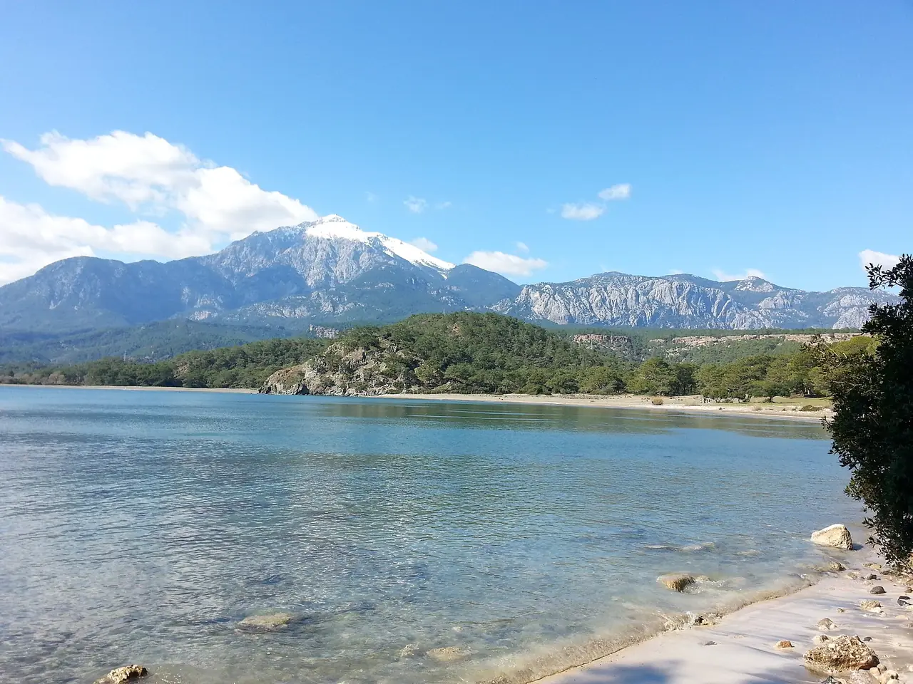
On the "a" line, Ulupınar and Beycik (23a) lead to Yayla Kuzdere (24a) and Gedelme (25a). The society's notes place Beycik below the slopes of Tahtalı. The municipality says the Lycian Way reaches its highest point, 1,800 m, above the cedar forests on Tahtalı Mountain. The summit, which the municipality gives as 2,366 m, is where the Tahtalı Olympos cable car ends.
The society's route updates add two warnings:
- Fake waymarks at Beycik. Two rival cafés re-mark the path to steer walkers to their doors. Keep west of the village, above all on the climb from the sea, or you end up on a long stretch of tarmac.
- No water high on Tahtalı. Above Yukarı Beycik a stand sells pricey drinks, but there is no water and no better campsite higher up. Camp before the yayla (summer pasture) or sleep in Beycik.
Göynük to Hisarçandır (stages 26–27)
Both lines on the society's list meet again at Göynük (26). The municipality's list of places on the route runs on from Tekirova to Kesme Boğaz, Göynük Canyon and Göynük. Göynük, Göynük Yaylası and Hisarçandır (27) all have places to stay on the society's list.
The Antalya end: Çitdibi to Geyikbayırı (stages 28–29)
The last two stages climb through the hills behind the city. In July 2020 the society moved part of stage 28 (Elmayanı–Çitdibi) off a forest road onto a red-and-white-marked footpath through pine and cedar forest. There is no water on the new section; the nearest source is at Üçsöğüt. From Çitdibi the route crosses a pass and runs past the ruins of Typalia and Trebenna to Geyikbayırı.
There is also an alternative final stage. From Üçsöğüt Yaylası a path marked yellow and red runs via Gedeller to the bus garage at Sarısu, with connections to the city centre, the bus station and the airport. Volunteers re-signed it in September 2020. These notes date from 2020–21, so check the update page for anything newer.
You may also see yellow-and-red marks nearby: the society says Kemer and Konyaaltı municipalities run their own local trails, some linked to the Lycian Way. Our Konyaaltı guide covers the city side.
Waymarks and navigation
- Red and white. The municipality says the route uses the French Grande Randonnée system: red-and-white stripes about every 50 m on paths and every 200 m on dirt roads, and a red cross where you have left the route.
- Gaps happen. The society re-marks routes every two to five years. Marks suffer most early in the year after winter rain, and new roads can cut through them.
- Take a map or GPS. The society keeps the route current on OpenStreetMap, suggests apps built on it such as OsmAnd, and warns that several other apps show outdated lines. It sells a Lycian Eastern Map at about 1:70,000 and a guidebook (new English edition, December 2022).
- Lost the marks? Go back to the last one you saw and search within about 100 m.
- New signs are coming. Hürriyet Daily News reported in May 2025 that the Antalya governor had announced new direction signs along the whole route. No completion date was given.
When to walk
The society recommends February to May or September to November and calls summer too hot for long walks. It advises against mid-December to late January, when storms and snow are common. The municipality says the route suits walking at any time of year. In the cooler months, read our Antalya in winter guide, and remember the society's rule of thumb: it gets about 7 °C colder for every 1,000 m you climb.
Summer brings a second limit. NTV reported in May 2026 that the Antalya Governorship's fire-prevention circular banned entry to forests from 1 May to 31 October 2026, with no exception mentioned for walking trails. Before a walk between May and October, check whether a new circular applies.
Water, food and beds
- Water: the society says villages have a clean source and you usually pass at least one a day. Some wells need a bucket and string, springs may dry up from August, and well water should be treated from June to the end of October. Carry extra on stage 28 and above Beycik.
- Food: the society says you never need more than two days' food, even on the longest section.
- Beds: apart from three high-level sections, there is somewhere to sleep every night. The online excerpt of the society's list (updated 2 November 2026) shows nothing in Çitdibi or Geyikbayırı, so check the full spreadsheet, and ask each host to phone ahead to the next.
- Fires: light them only in existing fireplaces, and make sure they are fully out.
Getting to the trailheads from Antalya
These come from the society's transport page, last updated in July 2021, so confirm times locally.
- Geyikbayırı: bus 521A from the Otogar Aktarma Merkezi, on the main road outside Antalya's intercity bus station, at 06:00, 12:30 and 17:30. It returns about an hour later. Line 501 runs every half-hour to Akdamlar.
- Çıralı: several buses a day from the Olympos stop on the main road, in spring and summer.
- Olympos and Adrasan: Çiçek Tur runs from Antalya to Olympos, Adrasan and Finike. Adrasan also has an early-morning bus and a minibus cooperative.
- Karaöz: a few buses a day from Kumluca bus station.
- Tekirova and Phaselis: our Phaselis page explains the turn-off from the coast road.
For the first leg from the airport, see our airport transfers guide.
Tickets for Olympos and Phaselis
- Olympos: the ministry's Olympos page gives daily hours of 08:00–19:00 (box office closes 18:30) and a €10 fee. Its Turkish Museums portal gives winter hours, 1 November to 30 April, of 08:00–17:00 (box office 16:30). They disagree for this time of year, so plan around the earlier closing.
- Phaselis: the Phaselis page gives 08:00–17:00 daily (box office 16:30) and €10. The portal's winter hours match.
Check on the day, and see whether a MuseumPass pays off.
Safety on the eastern stages
- Weather: the society says never to walk in mist or blinding rain. In late autumn and early spring, always carry waterproofs and a head torch.
- Kit: thick-soled boots with ankle support for the sharp limestone, and long sleeves against thorny scrub.
- Walking alone: generally fine, says the society, but take a tent in case mist comes down.
- Dogs: don't wave poles at an aggressive dog. Shout for the shepherd, and throw a stone only if you must.
- Emergencies: call 112. The society's trekker page still gives 115 for the gendarmerie, but Anadolu Agency reported in 2021 that all emergency lines, the gendarmerie's included, had been merged into 112.
Where to stay
For a coastal base with day walks, Olympos Lodge is in Çıralı, and our Kemer hotels list covers Tekirova and Kemer. The Kemer district guide covers the wider coast.
FAQ
Where does the Lycian Way start near Antalya?
The society treats Ölüdeniz near Fethiye as the start and Geyikbayırı, outside Antalya, as the end. From Antalya, begin at Geyikbayırı (or Sarısu on the alternative last stage) and head west.
How long are the Lycian Way stages from Antalya to Olympos?
The society's website and the municipality publish no stage distances or walking times; they are in the society's guidebook and maps. Olympos and Çıralı are stage 22, Geyikbayırı stage 29.
Do I need a permit to walk the Lycian Way?
None of the official pages we checked mentions a permit or fee for the path. The Olympos and Phaselis ruins charge entry. From May to October, check for a forest-entry ban.
When is the best time to walk the Lycian Way near Antalya?
The society recommends February to May and September to November. The municipality says the route can be walked year-round.